Deleted
Deleted Member
Posts: 0
|
Post by Deleted on Nov 1, 2010 21:47:13 GMT
Another gem I discovered in the Bere Alston bookshop today was an ancient coloured street plan of Torquay and Paignton. I remembered having one as a child – much scribbled over – but had began to think it a figment of my imagination as I never set eyes on another copy until finding one in Totnes a few years back. It’s unusual because most local street plans were simple black-and-white efforts. Geographia, the publishers, normally only produced coloured plans for the big urban areas. Whilst the Totnes copy was in poor condition – and even more scribbled and felt-tipped marked than my original – today’s find is pristine. There’s no date but I would put it as mid-1950s on the basis of new housing in Chelston. It shows landmark pubs - such as the Haywain and Golden Butterfly – although Torquay’s fire station still in Market Street (isn’t that incredible to believe?). Indeed, John Pike’s centenary history of the borough states the new fire station on Newton Road didn't open until 1957. What of the football ground in the first extract? No Drake Avenue or Frobisher Green on this map – can anybody shed any light on that old pitch? Pike reckons Armada Park dates from 1956.  Another sporting theme in the second extract – the Torbay Country Club golf course in Paignton. This is completely unknown to me – can anybody remember it?  Then, the part of the bay which has probably changed the most over the last fifty-odd years: the southern half of Paignton. There’s hardly any development there in the 1950s although there is sign of Standard Telephones. Oddly, over the weekend of the AFC Wimbledon FA Trophy game, I stayed in a B&B in Surrey run by the daughter of one of the first STC workers who moved down from the south-east. She recalled the building of Gibson Drive – known informally as “Siberia” – so I’m surprised the early part of the estate isn’t on the map:  Lastly, one for Budleigh, and it shows how the Borough of Torquay once had territorial ambitions towards annexing Shaldon. Not quite on the scale of Bolivia seeking a Pacific port but a definite sign of an intention to gain a foothold on the Teign (and why not?). All that was put to bed with the creation of the County Borough of Torbay in the late 1960s:  1950s cover design work with the inevitable palm trees and – yes – splendid use of Torquay United colours. Three maps for a fiver quite made my day.  |
|
Dave
TFF member

Posts: 13,081
|
Post by Dave on Nov 1, 2010 21:58:46 GMT
A great find Barton and I parked my car on Saturday in the lane beside that old football pitch and its certainly not there now as you will know. Some might well remember it and I know someone who has lived nearby for a long time and I'll ask them if they have any knowledge of it.
Did a google on the golf coarse and nothing came up and will have a chat with Carols mum as she might remember it.
|
|
Jon
Admin 
Posts: 6,913
|
Post by Jon on Nov 1, 2010 23:42:40 GMT
I knew that Chelston used to play at a ground in Nut Bush Lane before moving to Armada Park but never knew exactly where it was. Now I do and it was exactly where my brother-in-law's house now stands! If he gets worried by a couple of dodgy characters "casing the joint", I'll have to tell him its only Barton and Budleigh - the South Devon branch of the Defunct Football Grounds Society.
The third map solves another mystery for me.
Paignton Corinthians (who played a friendly v Torquay United in May 1951) was the most serious attempt ever made at getting a decent semi-pro side in Paignton. The driving force and Player-Manager was Paignton-born former TUFC player Russell Phillips.
They played in the Exeter & District League in 1950/51 and were all set to become founder members of the South Western League, with financial backers in place.
Their problem was their awful windswept ground with no facilities referred to as "Waterside" - which I assume must be the Playing Fields at the bottom of the Goodrington map.
Despite constant badgering of Paignton UDC for better facilities, they were unable to join the SWL in 1951. They moved to the Plymouth & District League instead - where they joined Dartmouth United, Brixham United and Totnes who all got cold feet over the SWL at the last minute, leaving Newton Abbot (temporarily without the Spurs) and TUFC Reserves a little in the lurch.
Phillips' ambitions were not dulled and he had a very good attempt at getting into Queen's Park - proposing an alternative Saturdays arrangement with the Rugby Club. Remember it was only a few years since Newton Spurs had ousted NARFC from Newton Rec.
It was felt that a semi-pro soccer club in the SWL playing at Queen's Park would have really taken off, but unfortunately it wasn't to be.
An attempt to get hold of a pitch at Galmpton failed and with further delays to the council's new fangled Clennon Valley development, Corries ended up folding after just two seasons at the Waterside.
|
|
Deleted
Deleted Member
Posts: 0
|
Post by Deleted on Nov 2, 2010 9:29:20 GMT
That’s excellent material about Paignton Corinthians, of which I knew nothing. How about this for a different angle? The map in question has uses two shades of green to indicate woodland, parks, sporting facilities, etc. It attempts to make a distinction between public and private without always succeeding. Look below at the extra detail around the Waterside area and you’ll see a small rectangular area behind Knapp Park Road:  Then consult another Geographia street plan, published just a few years before, and you’ll see this marked as a football ground. Was this the home of Paignton Corinthians? It’s now the Torbay Golf Centre, as advertised on the roof of the main stand at Plainmoor.  The church at Goodrington dates from 1939 and I would have thought the Waterside pub would be from a similar time. As for the golf course in Paignton, I believe it was part of the late 1920s transformation of Oldway into the Torbay Country Club. That brought tennis and bowls to Oldway with the bowls club still being known as Torbay Country Club. This 1930s map – sold as a map of Torquay even though it included Paignton – shows Oldway marked as the country club. And, on the left-hand fringe of the map you’ll see the monastery almost in the countryside. That’s still worth a look, tucked away in housing as it is these days:   |
|
|
|
Post by merseygull on Nov 2, 2010 11:03:29 GMT
The football ground in the first picture must have become Highland close...weeksland road feeds off it...
The lane running from nut bush lane down to the valley is, i think still there and I certainly remember walking down there as a kid....
The steps/lane seen running up from the valley to grenville avenue must be along the side of that wooded area that now sits there...
ATB,J.
|
|
|
|
Post by teddingtongull on Nov 2, 2010 18:31:17 GMT
Just spoken to my father and he remembers playing on the golf course in Paignton after the war. Unfortunately he can't remember when it closed. Did say there was a windmill on the course. Is that still there?
|
|
|
|
Post by aussie on Nov 2, 2010 19:06:42 GMT
Just spoken to my father and he remembers playing on the golf course in Paignton after the war. Unfortunately he can't remember when it closed. Did say there was a windmill on the course. Is that still there? There`s a windmill on the Crazy Golf course down the sea front as well! ;D Sorry, if ther was a windmill there then it should have had a protection order on it so some of it should still remain. I`ll see what I can google. |
|
|
|
Post by aussie on Nov 2, 2010 19:18:02 GMT
Well there ain`t nothin` on the net that I can find, just googled me tits off, got nipple marks on me keyboard now!
|
|
Deleted
Deleted Member
Posts: 0
|
Post by Deleted on Nov 2, 2010 23:22:27 GMT
Just spoken to my father and he remembers playing on the golf course in Paignton after the war. Unfortunately he can't remember when it closed. Did say there was a windmill on the course. Is that still there? That would be right. The lane running diagonally at the top of the map is Windmill Lane. The disused windmill is on the golf course side of the lane so was probably right on the edge of the course. The structure is still there with Windmill Lane now being a "back lane" between Longmead Road and Dolphin Court Road. |
|
Deleted
Deleted Member
Posts: 0
|
Post by Deleted on Nov 3, 2010 11:26:29 GMT
|
|
Dave
TFF member

Posts: 13,081
|
Post by Dave on Dec 29, 2010 11:38:49 GMT
A picture appeared in this weeks Bygones in the Herald Express taken from Dunstone House in Paignton, over looking the Windmill Golf Course. The image itself comes from a " Torquay by the sea" brochure that was published in 1900. maybe something Barton will add to his list to try and find in those old book shops he enjoys pottering around in. 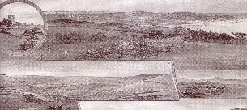 |
|
|
|
Post by aussie on Dec 29, 2010 15:28:14 GMT
Just found another wind mill, if you go to the map and click the left arrow twice and the up arrow a few times you navigate past Moles Cross and get to wind mill lane, there is a little whitish spot just off the road, if you then magnify a few times you get a great image of a restored windmill building but it has no sails. |
|
Dave
TFF member

Posts: 13,081
|
Post by Dave on Dec 29, 2010 17:17:32 GMT
Just found another wind mill, if you go to the map and click the left arrow twice and the up arrow a few times you navigate past Moles Cross and get to wind mill lane, there is a little whitish spot just off the road, if you then magnify a few times you get a great image of a restored windmill building but it has no sails. Aussie that windmill is called Long Barrow Windmill Its correct address is Long Barrow Windmill, Moles Lane, North Whilborough Forty years ago a man called Vince Hallam first set his sights on restoring the 200-year-old ruin, he fully achieved his dream. The quirky tall building narrows upwards over four levels, linked by a slender hand-built staircase inside, where all is smart and shipshape using maple, oak and teak. It is used more as a holiday home and is open all the year round. It costs between £350 - £600 per week (for two adults). To stay in the windmill. A bit more about the windmill and its history. The mill was constructed in the early days of the 19th Century when Britain was once more at war with France and there were plenty of french prisoners-of-war detained in nearby Dartmoor Prison. It is rumoured that having volunteered to build a bleak extension to the prison in forbidding granite the prisoners were anxious to make their mark with something a little more french and a little more uplifting - what better than a "Moulin Rouge" using the local red sandstone. With fitting english modesty the mill now has a creamy lime coat to cover the naked red stone and perhaps also to shed any Riviera showers! The forty five foot tower looking a little less saucy in its lime-render has four floors including the "pièce de resistance", an OBSERVATORY with a 360 degree view over the rolling, rich, red fields of the SOUTH HAMS. The conversion completed in 2001, with its round rooms, victorian iron bed and cosy lounge/dining/kitchen area, was designed more with honeymooners than families in mind, but for those who couldn't wait, there is a sofa bed in the living room suitable for children old enough to negotiate the tricky stairs up to the "MILLER`S EYE" at the top of the tower. 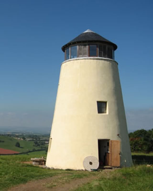 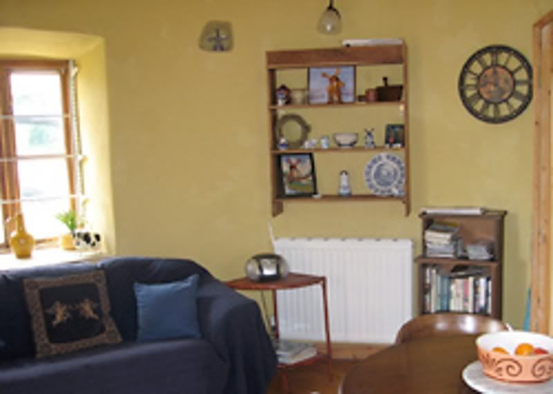 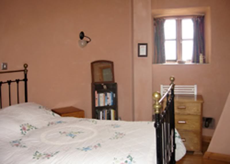 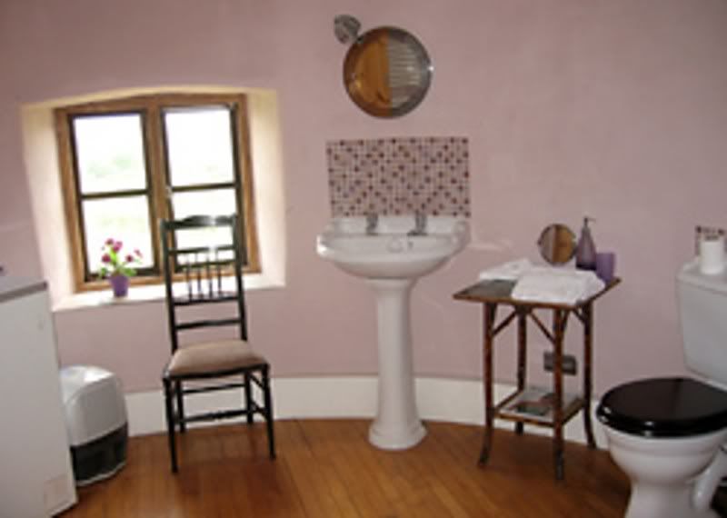 |
|
Deleted
Deleted Member
Posts: 0
|
Post by Deleted on Dec 29, 2010 20:00:21 GMT
Aussie that windmill is called Long Barrow Windmill. Its correct address is Long Barrow Windmill, Moles Lane, North Whilborough I've seen it written that five windmills were built around Torbay at the time of the Napoleonic wars in order to boost flour production. I assume these were at Paignton and North Whilborough as well as Brixham, Galmpton (near Windy Corner) and Windmill Hill, Torquay. North Whilborough is worth a look, not just for the structure itself but also the unusual views of Torquay. Not too far from the town but very much "out in the country" and probably a place few people venture (unless you're using it as a rat run through to Newton Abbot). Once you know the windmill is there you're likely to spot it from all over Torquay - often with Dartmoor in the background. North Whilborough is close to the route of the John Musgrave trail which takes you around some lesser-known parts of South Devon and is clearly signposted:     |
|


